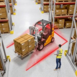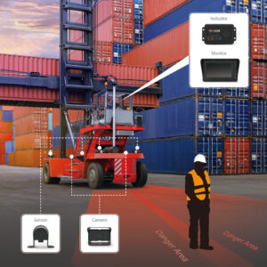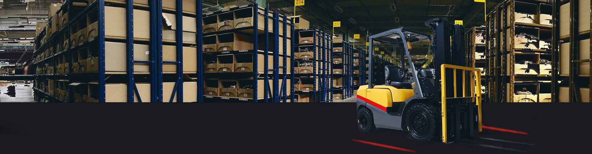

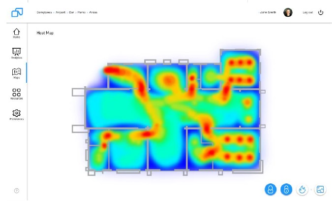
System gathers data, monitors and localizes resources in the enterprise. Functions of the system are dedicated both for being used by employees and in machinery park. With accuracy up to 0,5 m, the system allows to divide the object into spheres, determine a location of the user and also deliver data on the basis of which there are creating an exploited area of the heat map, the maps of heat motion, the intensity of events or load of communication paths. The system will inform authorized users about nonstandard events, which require intervention, for example, worker’s fall, breach of the level of security, alarm temperature/pressure values.
Why is it worth using that system in your company?
Check out its advantages:
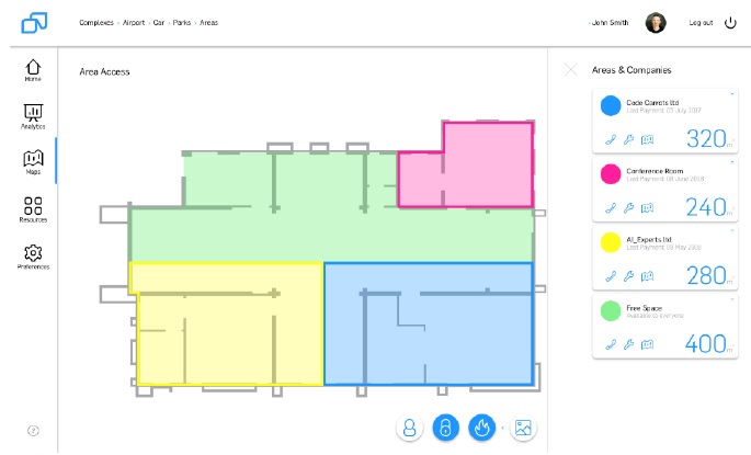
- Security – an indication of area and information about localization, allows increasing security for the whole object and separated spheres. Thanks to this, controlling system is able to register extraordinary events, support access control and send that information both to the user and the administrator.
- Exploitation of area – on the basis of analytic capabilities and real-time preview, monitoring system system delivers information about how people and machines move around the object. This allows optimizing of exploitation of the area and increases the effectiveness of the enterprise.
- Localization – based on stationary and mobile devices, positioning system gathers information about localization. Thanks to this, the administrator is able to use navigation possibilities inside the buildings for his own needs and outside systems, from which he uses.
Description
How does the system work?
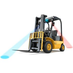
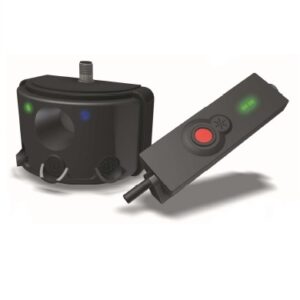
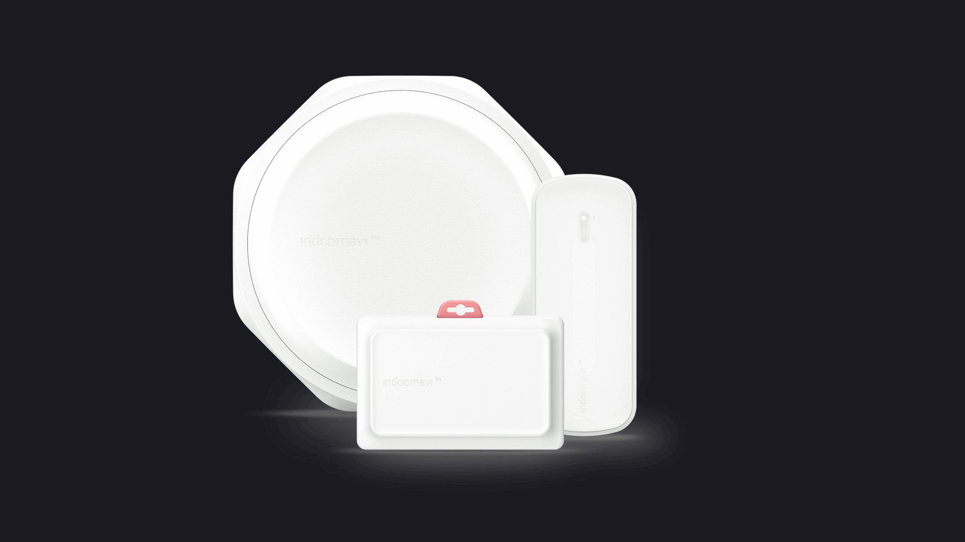
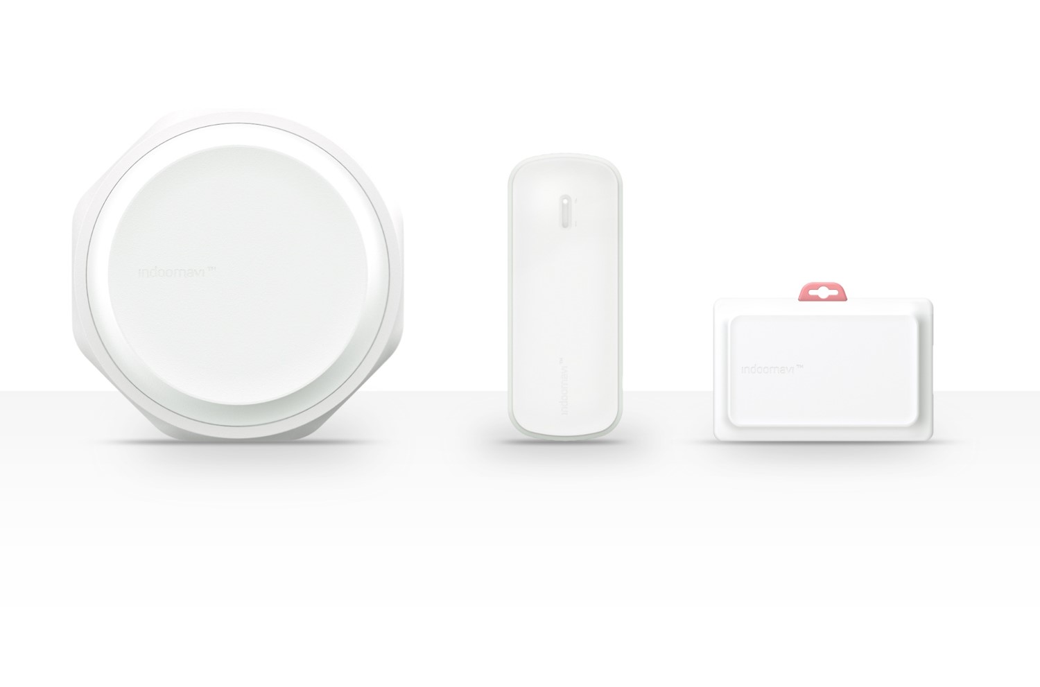
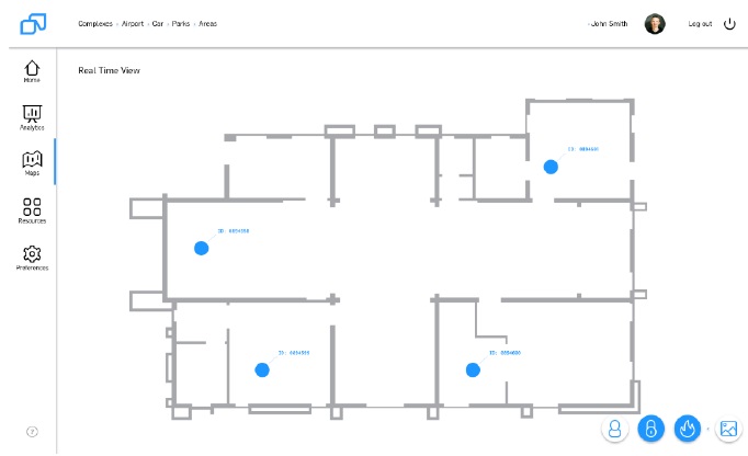
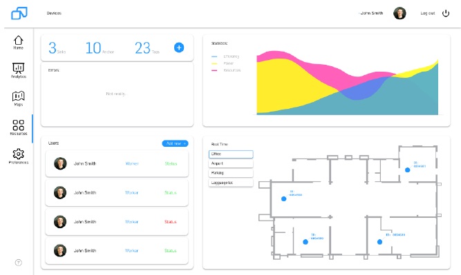
System is based on two devices: Tags and Anchors. Tags are small mobile devices, which are able to be in a form of badge for employee or device, which is put on the machine. Anchors monitor Tags motion, which is mounted stationary in the building or on the object.
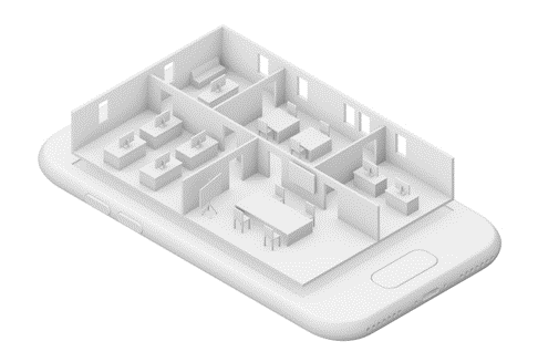
In this way, we are able to monitor object localization in real time, and the system is able to warn about dangers for the user and also for the administrator. Wide configuration possibilities, allow generating heat maps, reports including usage of spheres, and also information concerning potential collision places and elements, which can be improved. What is important, the system allows delivering navigation for final user around the object.
In this way, using high accuracy localization service is multistage.
For managers:
The system delivers data, which allows determining, how one is able to improve the functioning of the enterprise, security and how to exploit the area and resources. In this way, the manager gets access to full analytics, which has got a direct impact on the quality of management.
Process optimization is the natural result of system operation. Knowledge about localization, the time of implementation tasks and appearing events, allow to the digitization of process documentation and identification of occurring problems.
For employees:
Thanks to navigation, the time of reaching employee to the point being sought is shortened, working time can be used more efficiently. Badge owns inbuilt fall control function, what significantly improve the security of work. Employee budge may constitute support for access control system and also the security system.
Security in moving around the whole object. Segregating work and possibility of navigation. Access for spheres without the necessity of manually reflecting the identifier and warning about potential dangers.
Specification:
The system is based on stationary devices – Anchors and mobile ones – Tags. The place of implementation affects the number of devices and the final shape of the structure.
Thanks to two-way communication, the system is able to be as a basis for managing data reading devices from sensors (date of loggers), remote management of infrastructure system elements and even it can constitute support for remote automatic systems (robots).
Work temperature of whole equipment range from -20 up to 45°C, what allows to extend the system for parts of the enterprise, which are outside the building.
Navigation and Controlling System inside the buildings was created so that its installation and calibration was fast and intuitive. The system is equipped with automatic calibration module, what can accelerate implementation and also allow to extend system after its actuation. Remote management of the devices, facilitate maintain the system – especially through remote software actualization of devices.
In the case of machines and vehicles, exploitation of devices is without interference in vehicle construction.